Location plan guidance
Uploading a site boundary
Exporting a geospatial file
If you have already created your site boundary elsewhere, by using certain professional software tools you can choose to upload the location data into the Planning Portal. We accept .JSON file formats, and you can export this file type from QGIS or ArcGIS software into the map feature.
Use the links below to read the tutorials to find out how to do this for each software application.
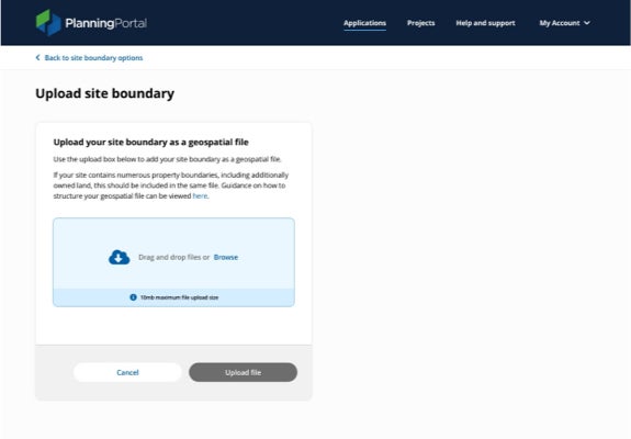
Note: If your site contains numerous property boundaries, including additionally owned land, this should be included all in the same file.
Uploading a geospatial file
Once the file is exported, simply click, or drag the file into the ‘Upload site boundary’ section of the Planning Portal and our system will upload it to the site boundary mapping tool.
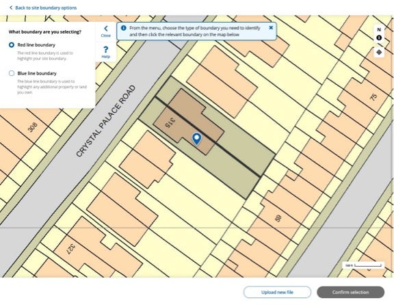
The imported boundaries will be shown as black boundary lines. You will need to highlight which boundary lines show the main site of the application. This will turn the black boundary to red, showing that the boundary is set.
If there are any additional related properties to be included, you can select the ‘Blue line boundary’ tool and continue to mark in the same way. Complete this by clicking ‘Confirm selection’ to continue with your application.
- https://ecab.planningportal.co.uk/uploads/1app/location-plan-export-tutorial-QGIS.pdf
- https://ecab.planningportal.co.uk/uploads/1app/location-plan-export-tutorial-ArcGIS.pdf