Location plan guide
About the location plan feature
Our location plan feature provides a convenient and easy-to-use way to create a location plan to support planning applications.
There are two steps required to do this:
1) Drawing the site boundary
2) Reviewing and generating the location plan
More information can be found in the other sections of this guidance:
Drawing a site boundary
Uploading a site boundary
Reviewing and creating a site location plan
Confirming and accessing your location plan
What is a site boundary?
The site boundary should be outlined on the map and show the main site related to the application.
Drawing the boundary allows you to correctly identify the site and highlight important information to the Local Authority.
Site boundary example
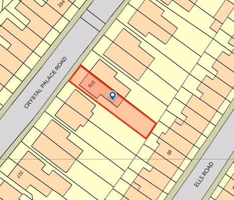
Main site for application is outlined in red.
What is a location plan?
A location plan is a document that is often required by a Local Planning Authority as part of a planning application. It should show the location of the proposed development in relation to its surroundings. This enables the Local Authority to properly identify the land to which the application relates.
A location plan should:
- Be at an identified standard metric scale (typically 1:1250, or 1:2500 for larger sites) and should show the direction north
- Be scaled to fit on an A4 size document
- Show sufficient roads and/or buildings on land adjoining the application site
- Show application site boundaries and all land necessary to carry out the proposed development. i.e., land required for access to the site from the road, outlined in red
- Show a blue line around any other land owned by the applicant that is close to or adjacent to the property.
The plan will typically illustrate the following:
- The site boundaries
- Roads and/or buildings on adjoining land
- Land necessary to carry out the proposed development (outlined in red)
- Any other land owned by the developer that is close to or adjacent to the site (outlined in blue).
Formerly, the creating of this document occurred outside of the Planning Portal. Now, our system will give you the opportunity to set the boundary, review, and generate a location plan needed for the application.
Note: A location plan is different to a site plan (also known as a block plan) which is specifically focused on providing more detail of the development within the site boundaries.
Find out more about plans and drawings
Location plan example
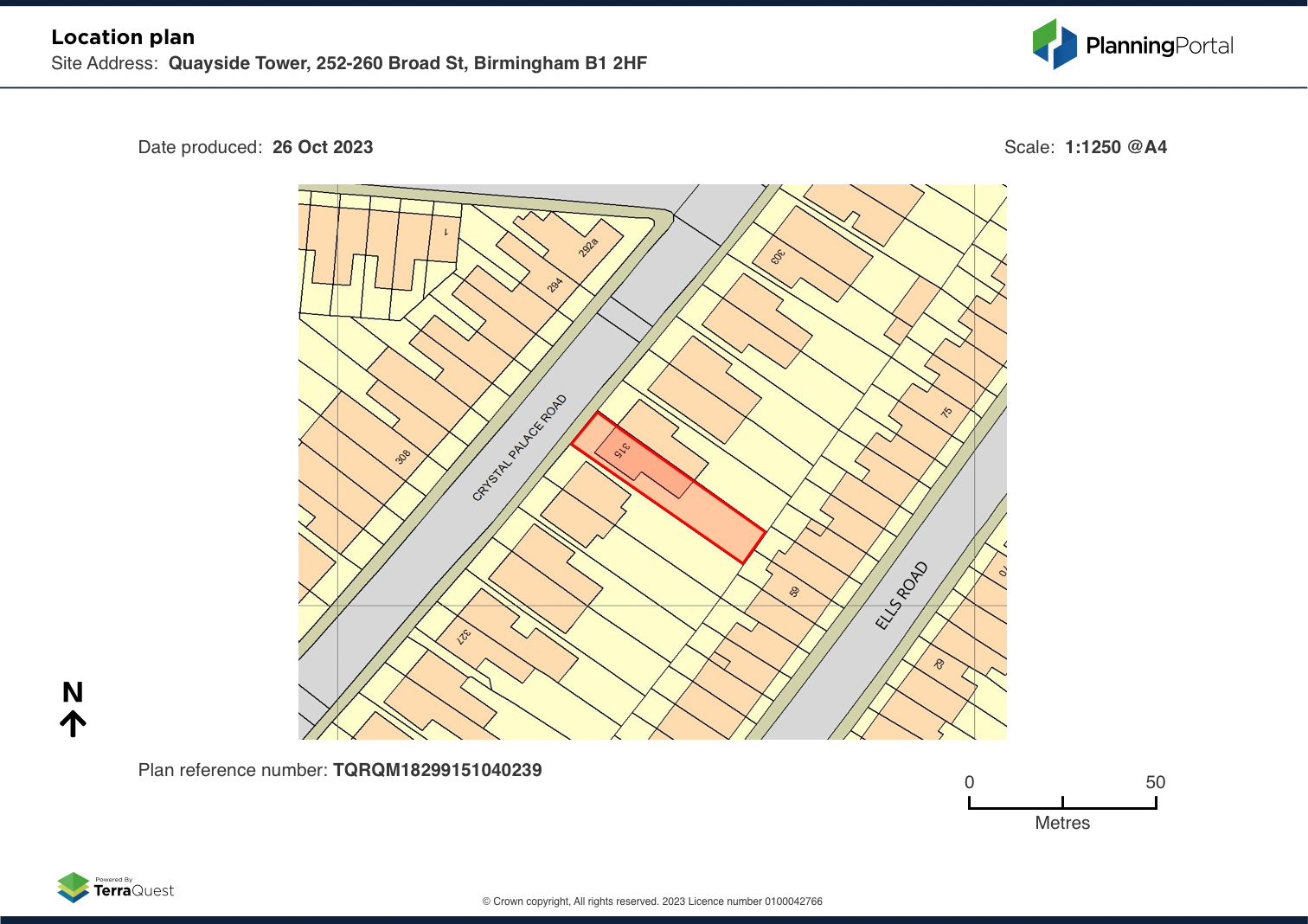
A location plan is a supporting document for planning applications on which the site boundary is displayed.
More information
Read more about how to draw a site boundary and supporting information
Next
Location plan feature – FAQs
Terms and conditions