Location plan guide
Reviewing and creating a site location plan
Location plans created on the Planning Portal check against the following legislative criteria:
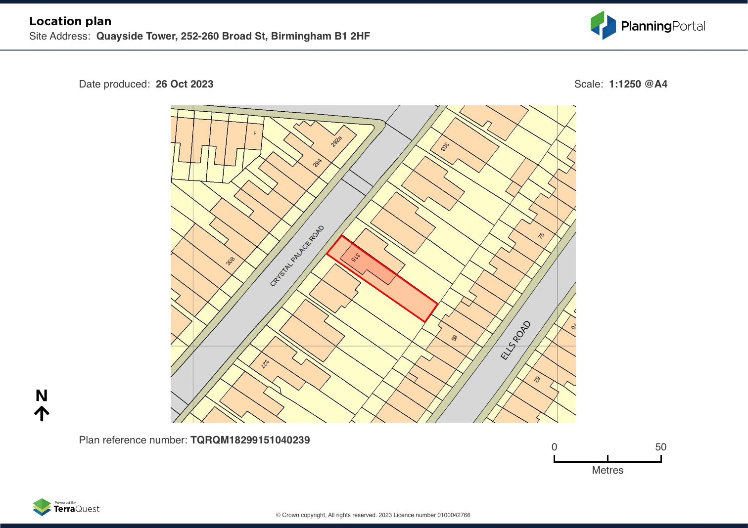
- Show the direction of north
- Fit on either A4 or A3 document sizes
- To scale (typically 1:1250 or 1:2500 for larger sites)
- Provide an Ordnance Survey license number
- Generate an up-to-date map.
Note: Local planning authorities have local level requirements for valid location plans, we will provide guidance and tools to meet national requirements, it is up to you to review and create the location plan as accurately as possible.
If you are not sure whether your plans are suitable or require further assistance, you should contact your local planning authority for advice.
Sites in excess of 10 ha in area and/or irregular in shape
The location plan feature has two scales for the maps, 1:1250 for standard site locations and 1:2500 for larger rural sites.
For the 1:2500 scale location plans: The 1:2500 scale location plans fit on to A4 paper. These cover an area of 22 hectares on the ground. This size location plan can be used for large sized developments, or developments in a rural area.
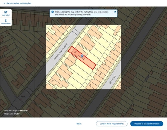
Reviewing your location plan will allow you to create a valid location plan
The review step prompts you to check that your location plan meets requirements. The review steps will prompt you to check the following are included:
- The site boundary (red line boundary)
- Any additional nearby or adjoining land or buildings, if applicable (blue line boundary)
- Two or more named roads if possible, or if not, one named road and a landmark.
Reviewing your location plan
Example of a valid location plan
Hints and tips for a valid location plan
The review process ensures that your site boundary is identifiable, this is done by providing two elements of detail regarding your site boundary’s location. This is commonly done by showing two different road names.
However, this may not always be possible, so to increase the likelihood of a valid application you can mark with one road name and a landmark, if necessary, using the label function.
Labels
After drawing your boundary, you can use the labels function to identify roads and landmarks. The simple function lets you add a name label and adjust the position of where the label is placed, as well as rotating the label. You can also go back and edit labels before submitting.
Some landmarks to consider labelling are rivers, lakes, churches, farms, barns, ponds, historical buildings (towers, castles) cemeteries, parks, football pitches, golf clubs or public paths.
Adding labels
When you come to confirm your site boundary to create the location plan, point two in the check asks if your boundary 'Shows two different road names or a road name and a landmark' if your drawing doesn't meet this, or any, of the criteria you can choose 'No' in response to 'Does your location plan meet these recommendations?'. This will allow you to revisit the boundary drawing and add labels using the option from the right-hand guidance menu.
Reviewing tips
- Ensure the site boundary is visible
- Two different road names are visible
- Or one road name and a landmark
More information
Read more about how to upload a site boundary and supporting information.
Next1
- https://www.planningportal.co.uk/services/help/location-plan-feature/confirming-and-recieving-a-location-plan
- https://www.planningportal.co.uk/services/help/location-plan-feature/uploading-a-site-boundary
- https://www.planningportal.co.uk/services/help/faq/applications/site-boundary-and-location-plan
- https://www.planningportal.co.uk/services/terms-and-disclaimer